 |
| Northwest Boundary Dike |
| South Carolina Department of Archives and History |
| National Register Properties in South Carolina Northwest Boundary Dike, Richland County (Address Restricted) |
| |
| Northwest Boundary Dike |
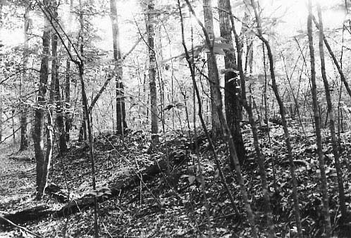
The Northwest Boundary Dike is significant for its association with the agricultural settlement of the Congaree Swamp and for its ability to yield information about settlement patterns in the region. James Adams constructed the dike on a 4,000-acre parcel of land granted to him in 1839. By building the dike, he sought to control the periodic flooding of the Congaree River in order to utilize the fertile swampland on its border to grow crops. Following his death in 1841, his family chose not to continue the dike project and the structure remained unfinished. It is an approximately 10-to-30-foot-wide-by-5-foot-high earthen dike running north to south for approximately 2000 feet. The length of the dike is broken in several places by gaps caused by erosion and inundation. The structure is covered with mature hardwood trees, many dated up to 150 years old, and other vegetation. Listed in the National Register November 25, 1996.
View the complete text of the nomination form for this National Register property. In addition, the Historic Agricultural Resources of Congaree Swamp National Monument, 1740-1900 includes historical background information for this and other related National Register properties.
Most National Register properties are privately owned and are not open to the public. The privacy of owners should be respected. Not all properties retain the same integrity as when originally documented and listed in the National Register due to changes and modifications over time.
Images and texts on these pages are intended for research or educational use. Please read our statement on use and reproduction for further information on how to obtain a photocopy or how to cite an item.
Images provided by the South Carolina Department of Archives and History.